

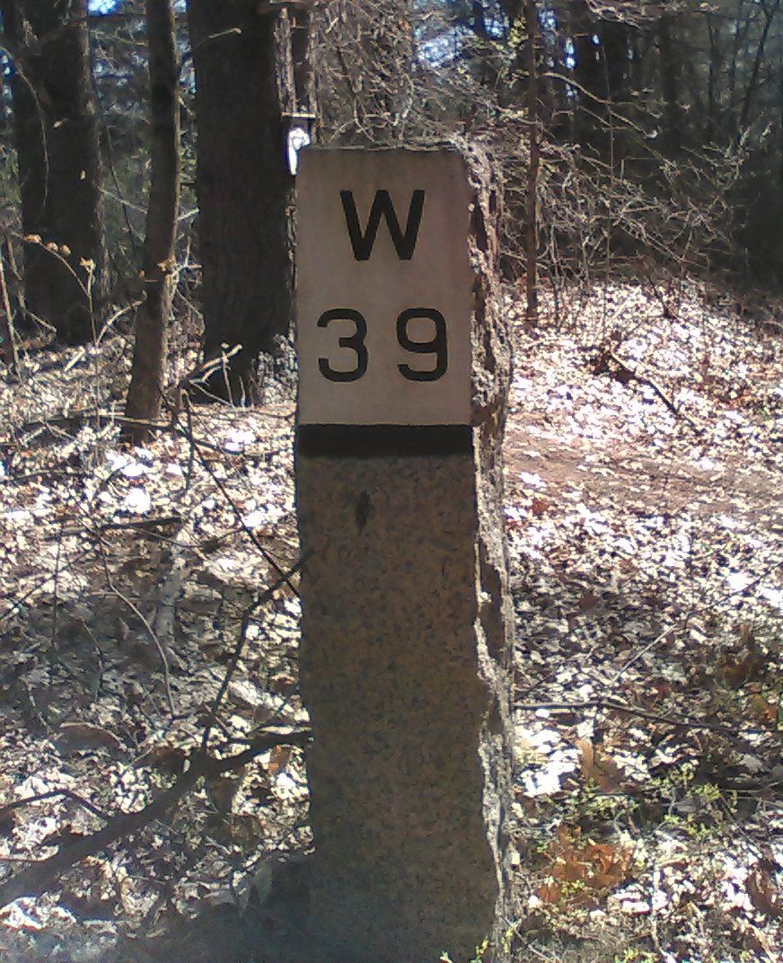
The path of the current rail trail originally operated as the single-track Worcester & Nashua Railroad starting 1848. The track was extended to Portland, Maine, in 1874 and was taken over by the Boston & Maine Railroad in 1886. The original granite markers along the trail give the distance to Worcester and Portland.
In the early 20th century, the Ayer-Nashua line carried a heavy load of freight traffic as well as passenger trains traveling between New York City and Bar Harbor, Maine.
Although a second track and signals were added around 1912, most traffic moved to the rail line running from Ayer to Portland via Lowell, Mass. Passenger service on the Nashua line ended in 1934. Freight service ended in 1981.
For more historical information, see the kiosk along the trail at Station St. in Groton. (map)
The Massachusetts Department of Environmental Management bought the abandoned track in 1987. Local communities helped to plan and design the rail trail in 1996–1997.
The Massachusetts portion of the Nashua River Rail Trail was constructed in 2001–2002. It is now managed by the Massachusetts Department of Conservation and Recreation (DCR). In 2005 the trail was extended into New Hampshire.
You can also explore points of interest in each town along the trail.
A few historic sites near the NRRT in Dunstable:
See a larger map.
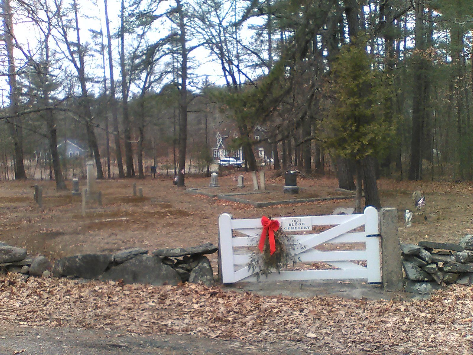
Blood Cemetery. The Blood family traces its heritage back to the original settlers of Dunstable. The family cemetery contains the grave of a Civil War veteran and the one of the Town's few Spanish-American war veterans.
Site of School House #5. The triangle of land at the intersections of River Street and Hollis Street was the site of one of Dunstable's five school houses. A stone marks the location of the school's well.
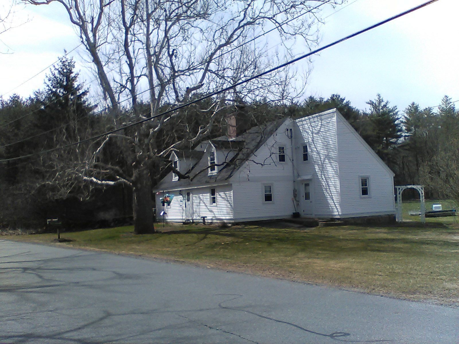
69 River Street. This former Blood family home was built in the 1820s. It is currently owned by St. Anselm's Abbey and the land is farmed by a local family.
A few historic sites are very close the rail trail:
See a larger map.
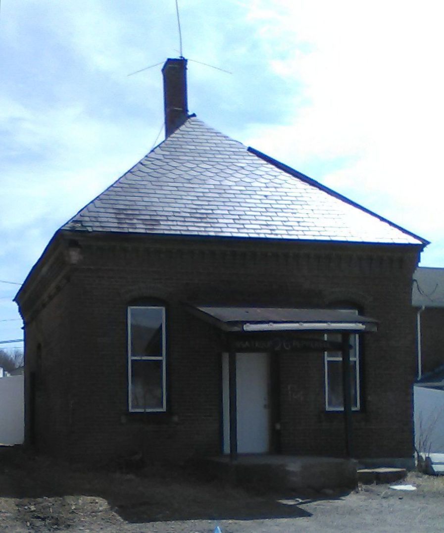
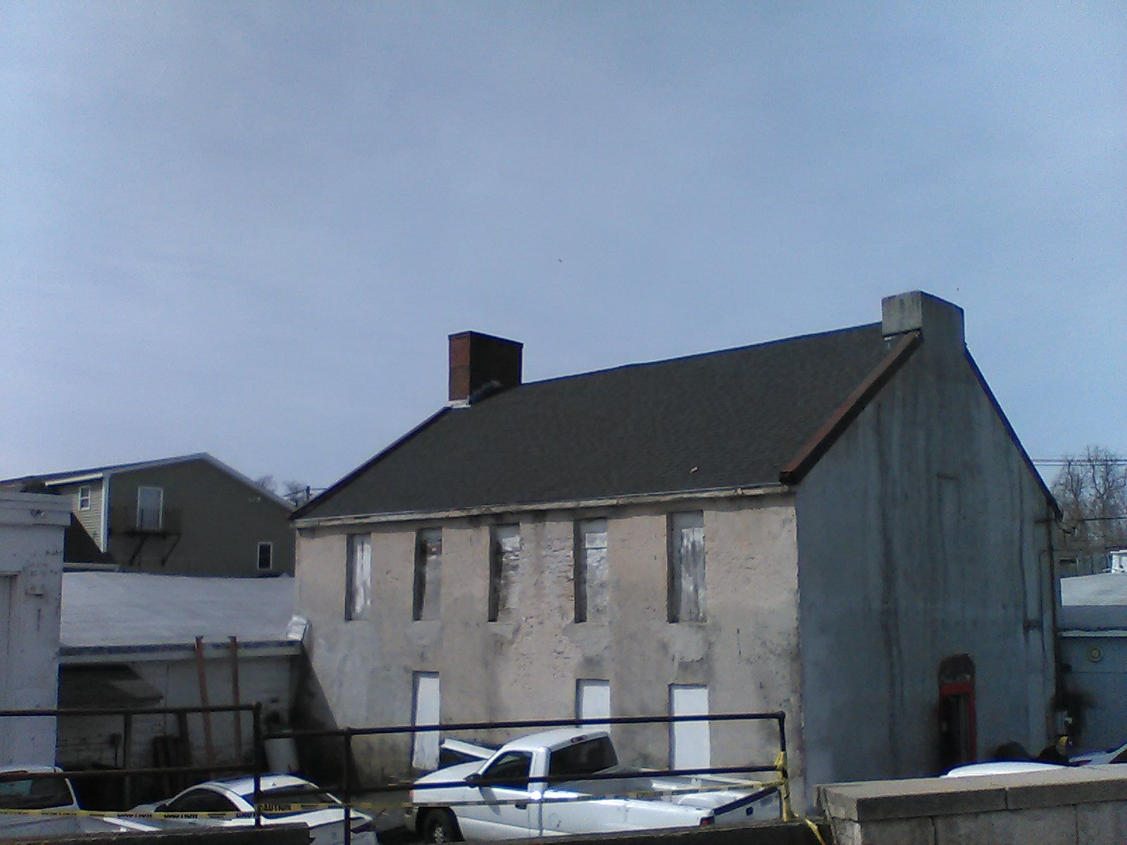
The Lock-Up. Next to the rail trail parking lot, this former police building had cells to temporarily hold prisoners.
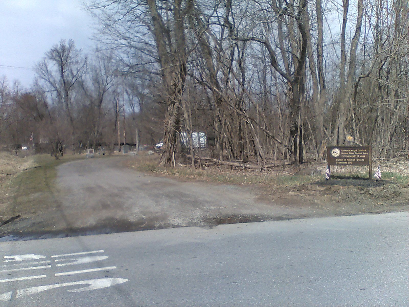
Prudence Wright Overlook. A scenic overlook of the Nashua River and the covered bridge. Near this spot in April of 1775 Prudence Wright and a group of women captured several British soldiers.
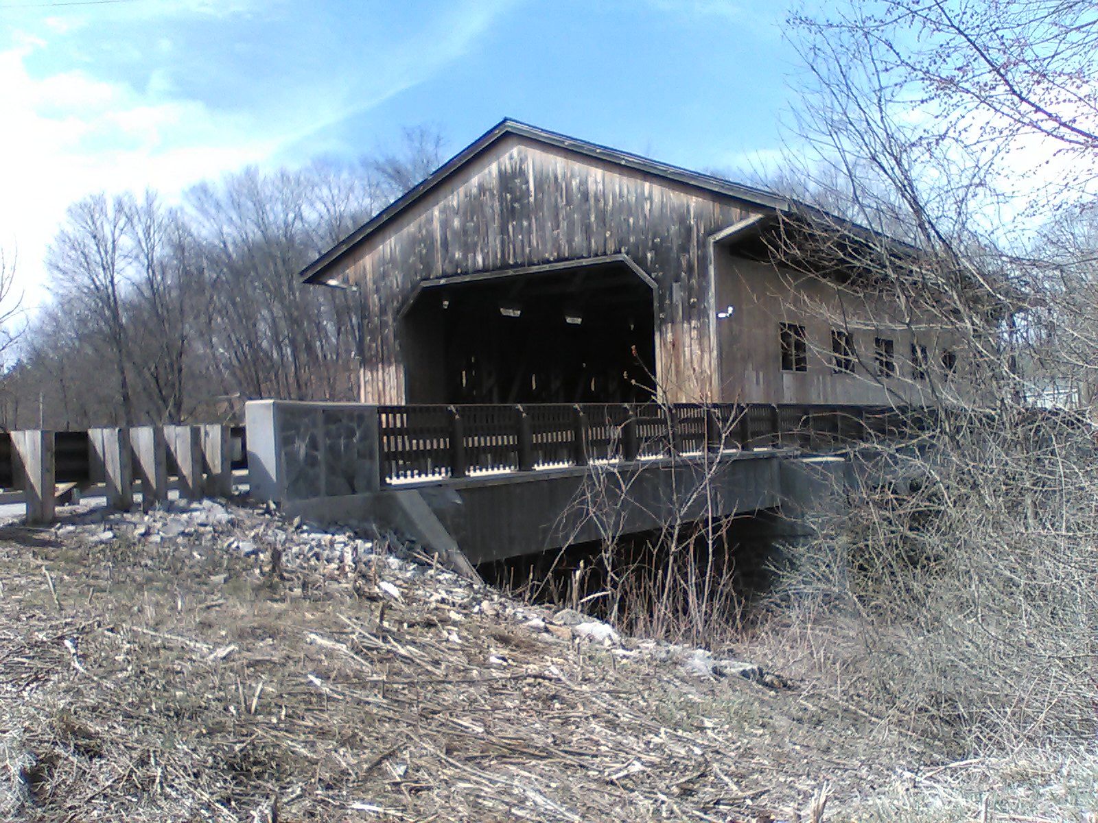
Pepperell Covered Bridge. A covered bridge has carried traffic over the Nashua River since about 1740. The current bridge was opened in 2010.
A few other sites are further along Main Street:
See a larger map.
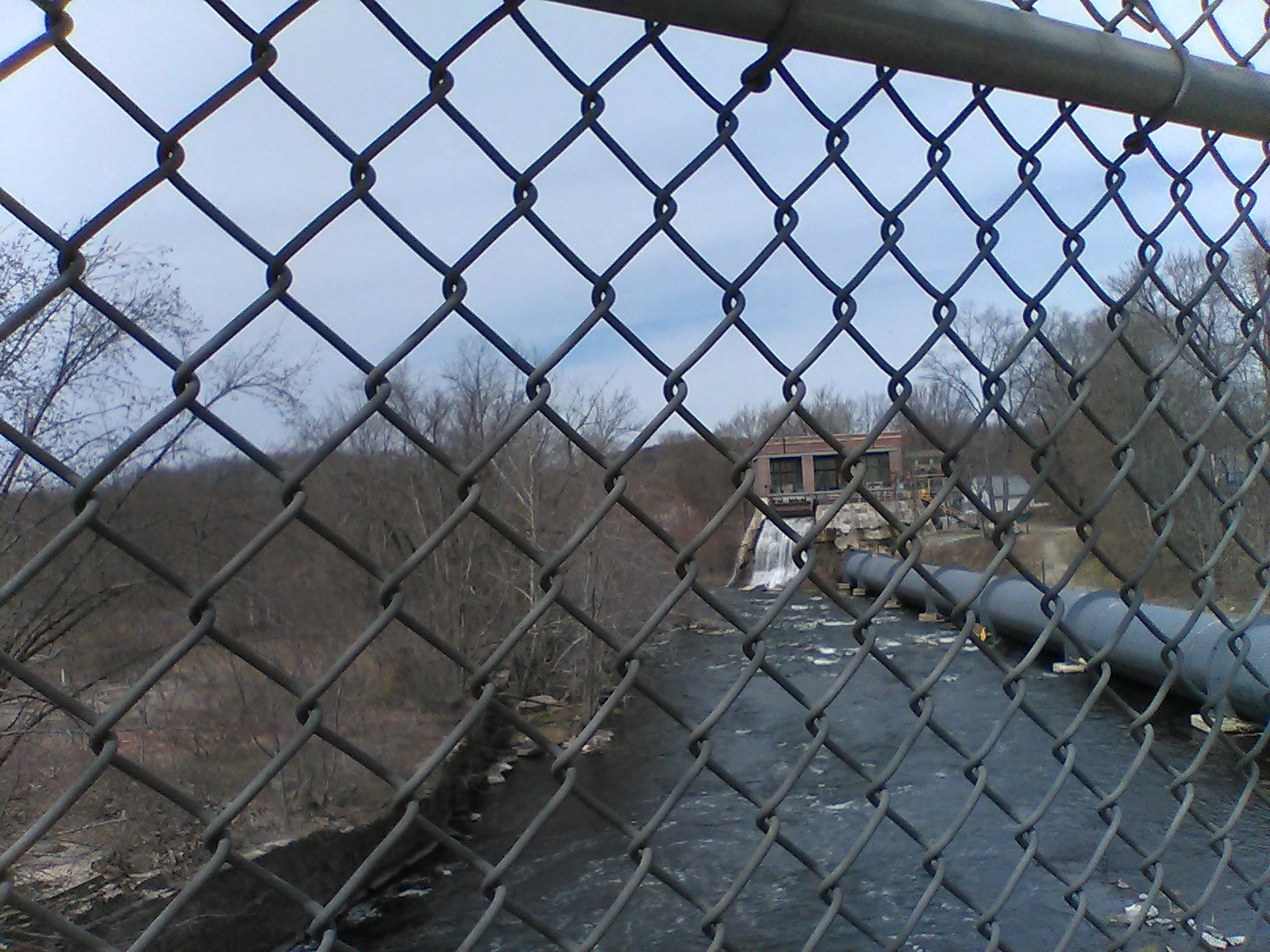
Paper mill site. As you cross the bridge you can see the remains of a paper mill that operated on this site until 2002. The associated hydro-electric plant continues to operate.
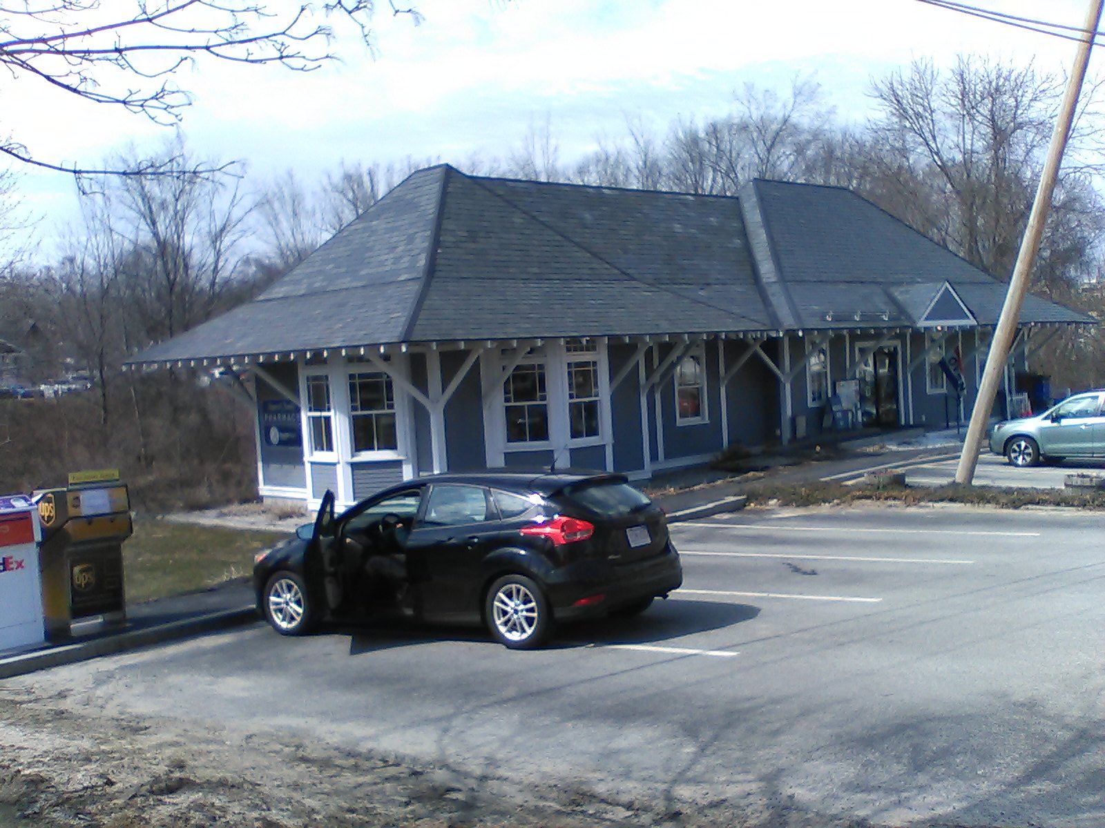
Brookline & Pepperell Depot. The Brookline & Pepperell was a branch of the Fitchburg Railroad. It passed under a "hump" bridge on Main Street and the original depot building is now a pharmacy.
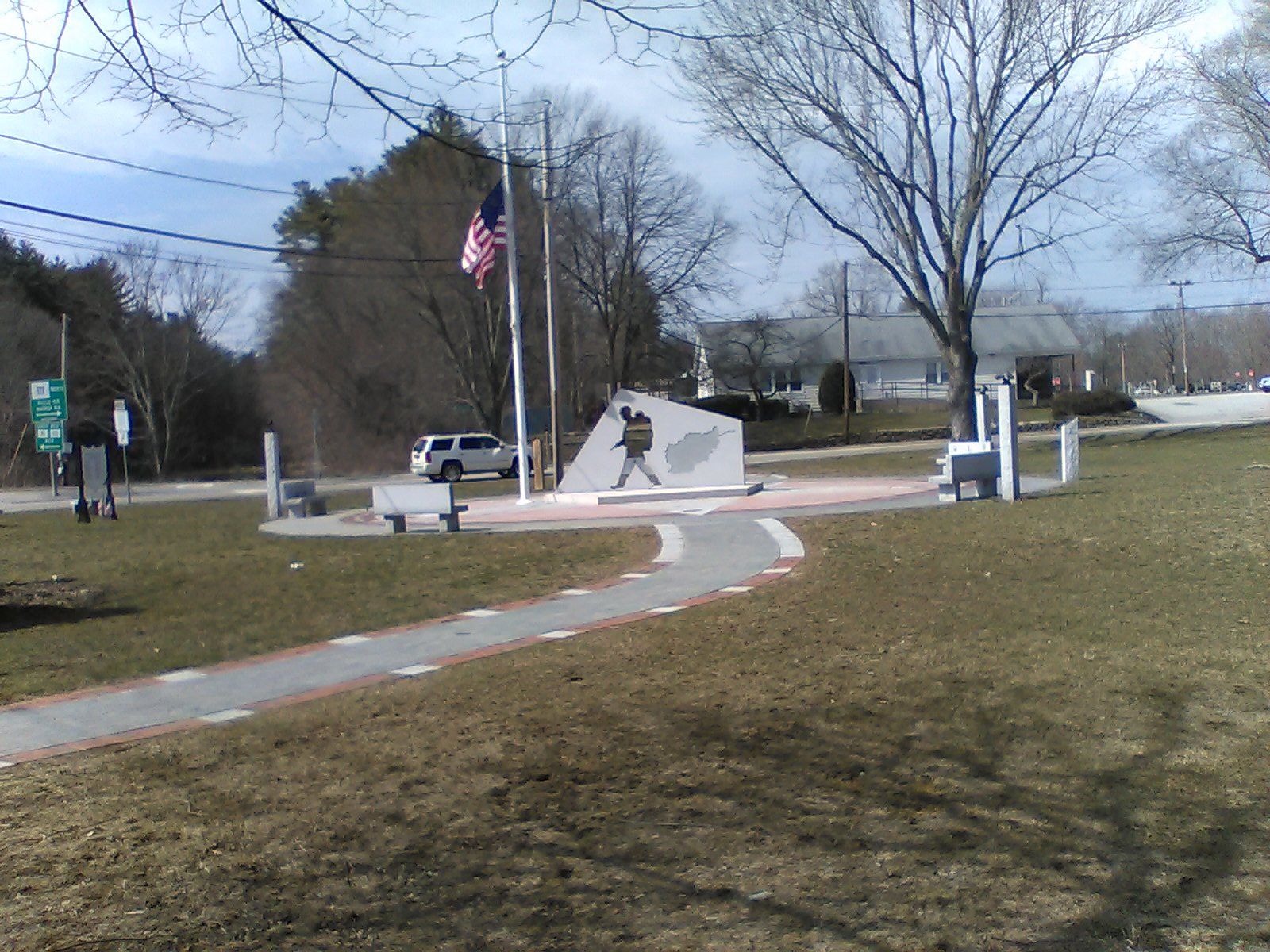
Middlesex Global War on Terror Veterans Monument. Dedicated in 2019, the Middlesex GWOT monument honors those who served in Afghanistan and Iraq.
Downtown Groton is rich in historic buildings.
See a larger map.
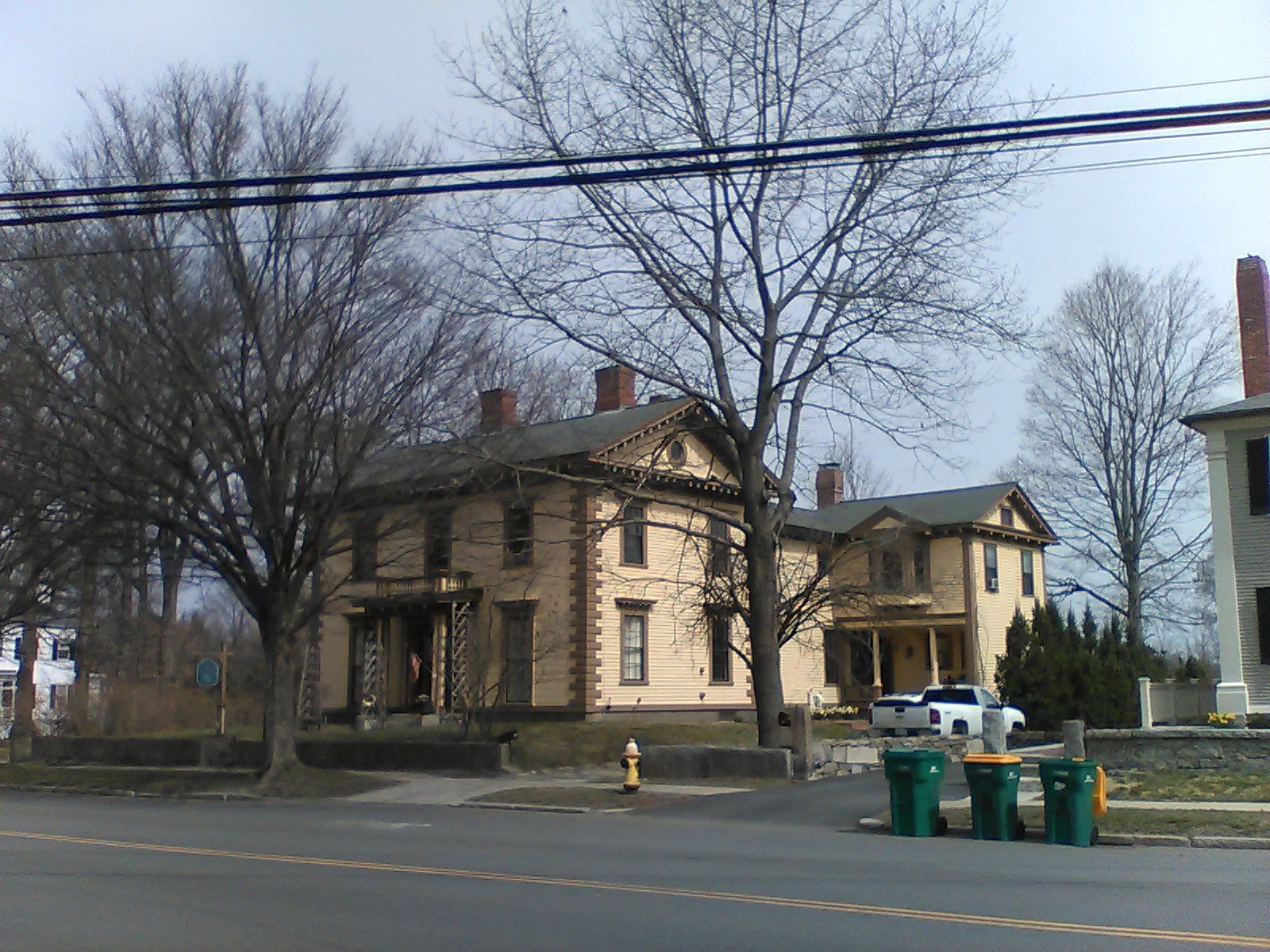
Groton History Center, 172 Main Street. The Governor Boutwell House, built in 1851, is now home to the Groton Historical Society.
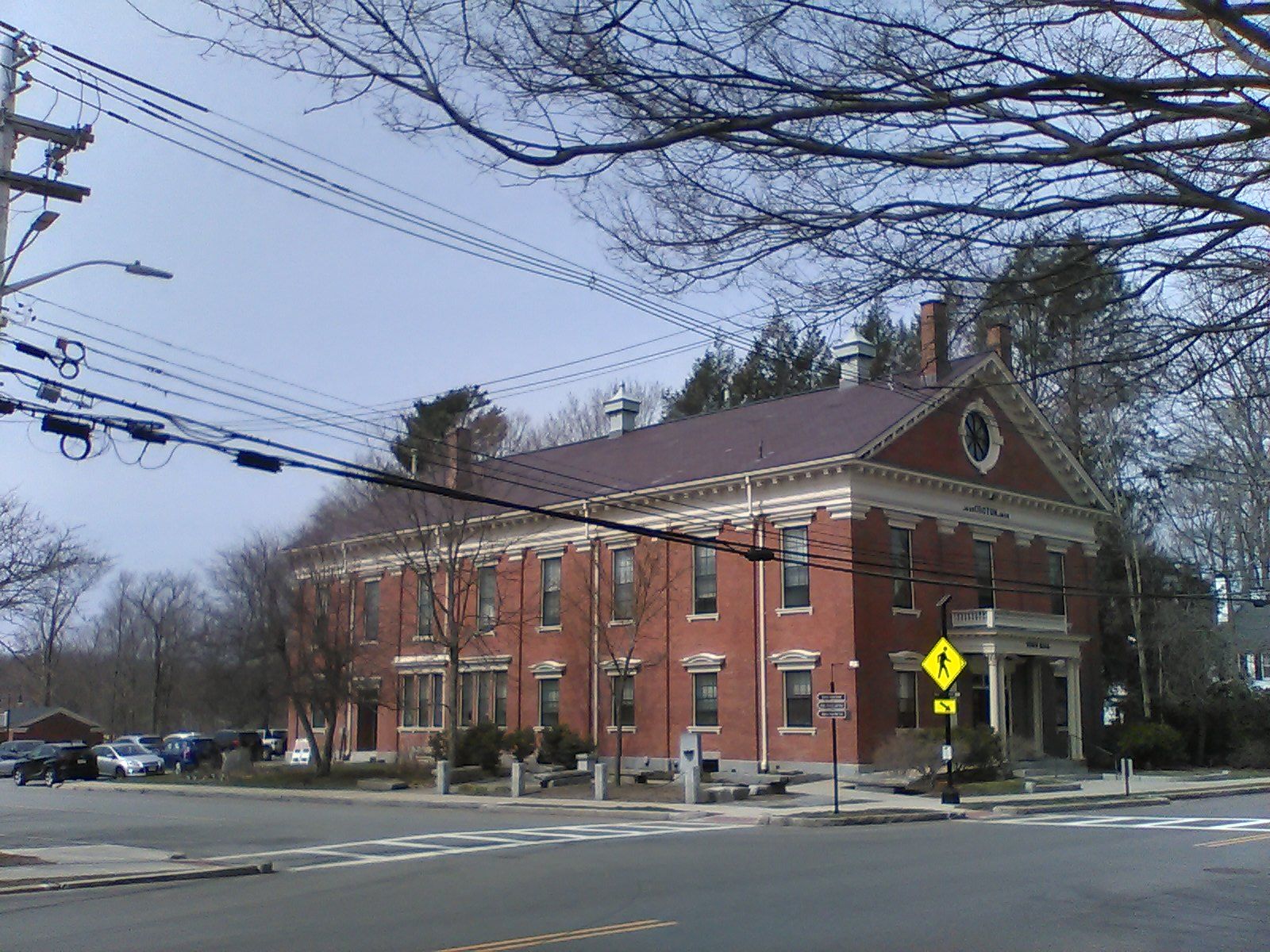
Groton Town Hall, 173 Main Street. This Victorian Eclectic style building was dedicated in 1908.
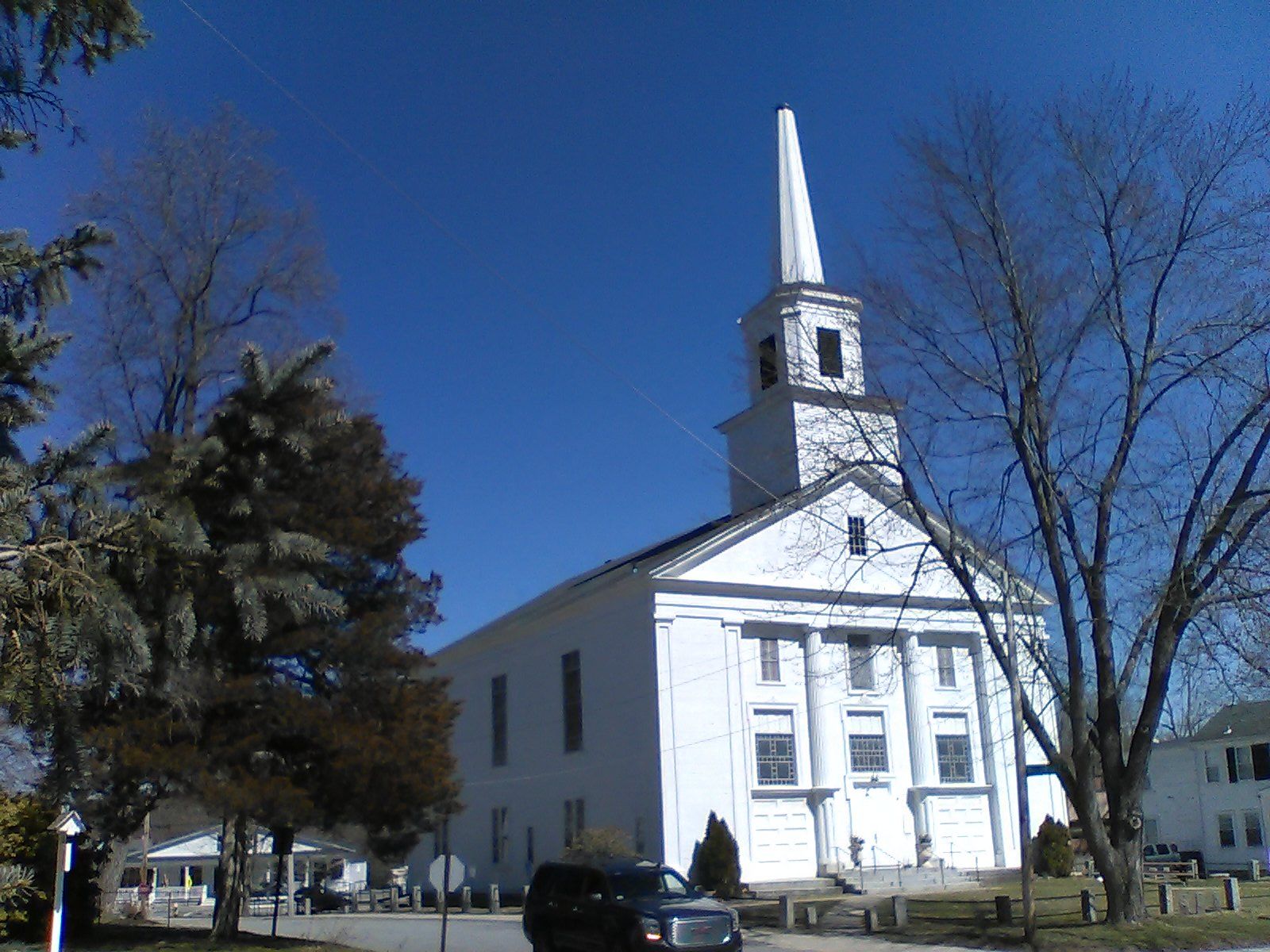
Union Congregation Church, 218 Main Street. This Greek Revival style church was built in 1827. The entire building was raised and a first floor added in 1887.
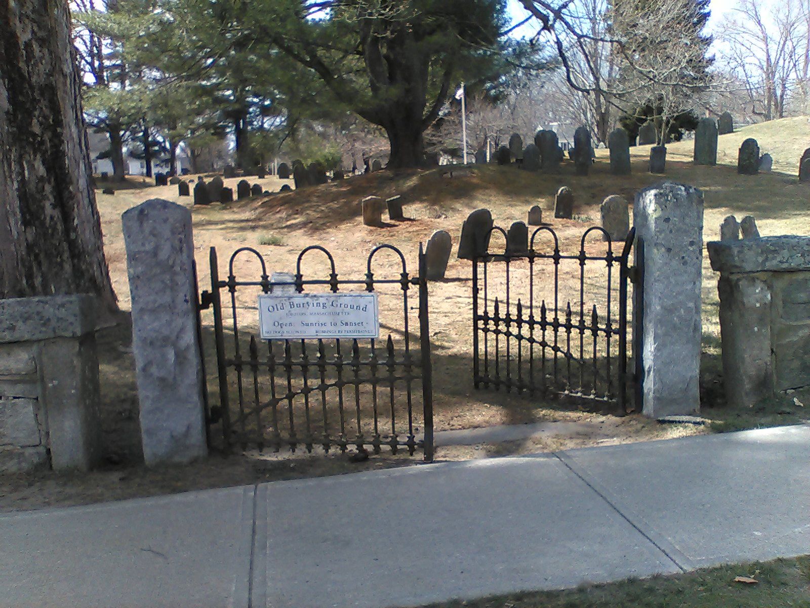
Old Burying Ground, 32-44 Hollis Street. Dating to 1678, the Old Burying Ground was the only place of burial in town until 1847. Burials continued there as late as 1900.
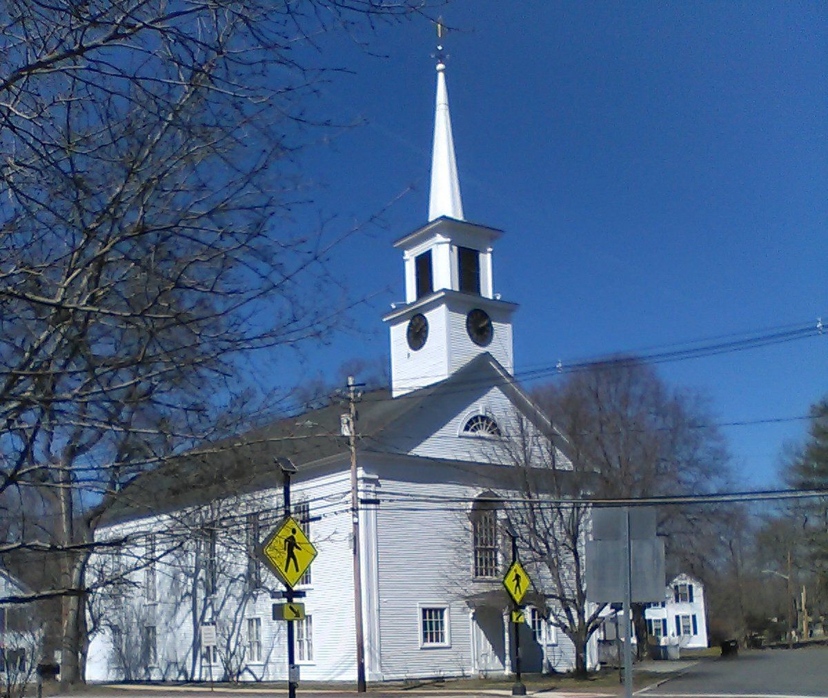
Old Baptist Church, 365 Main Street. Completed in 1842 on the site of a tavern, this church has housed the town clock since 1897.
A few other sites are further south:
See a larger map.
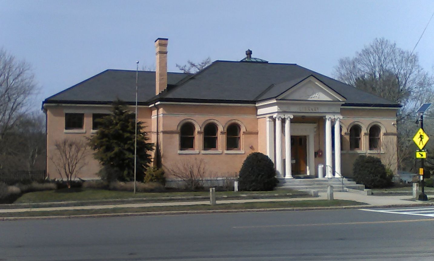
Groton Public Library, 99 Main Street. Originally built in 1893 the Classic Revival style building has been expanded several times.
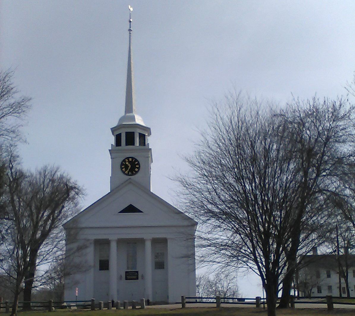
First Parish Church, 1 Powderhouse Road. Built in 1755 this church features a clock dating to 1809 and a Paul Revere bell cast in 1819.

Bancroft's Castle, 141 Lowell Road. The remains of a 1906 building atop Gibbet Hill. A steep trail leads up to the ruins where you will also find sweeping views of the area.
Several historic sites are close the trail in downtown Ayer.
See a larger map.
Park House. Visible from the NRRT parking lot, the Park House is the oldest home and Ayer and was the oldest home in Groton before Ayer became a separate town.
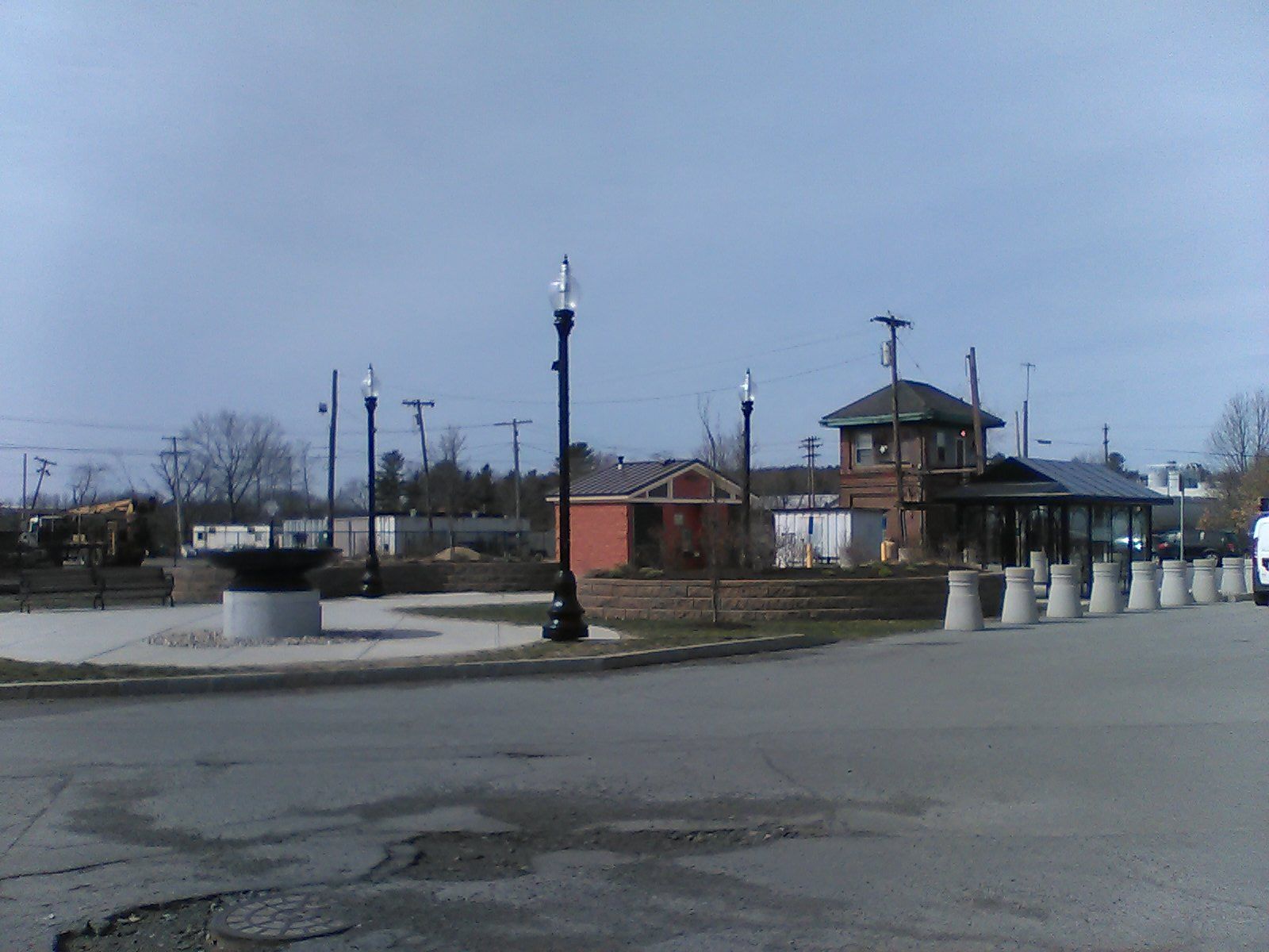
Depot Square Park. Across from the end of the rail trail behind 70 Main Street, Depot Square Park includes a historic fountain, restrooms, and drinking fountains.

Ayer Town Hall. Built in 1876, Ayer's Town Hall at 1 Main Street is a striking work of architecture in the heart of town.
